Log in
All resources
Create a design
11,660 Free Images of Old Map
bibliothèque nationale de france
maps by willem and johannes blaeu
maps of paris from the david rumsey historical map collection
baroque
atlas des anciens plans de paris by imprimerie nationale, 1900 from the david rumsey historical map collection
atlas map
david rumsey historical map collection
details of old maps
18th-century maps of paris
hamburgische elbkarte von melchior lorichs
old maps of algiers
maps from gallica
london borough of camden in art
william h. prior
print room of the university of antwerp
plattegrond van antwerpen
eran laor cartographic collection
willem albert bachiene
maps from the earth and its inhabitants, vol. ix
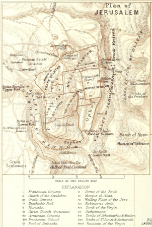
old maps of the holy land
maps of oudenaarde city walls
old maps of oudenaarde
maps of utrecht (city) city walls
old maps of utrecht (city)
old maps of ghent by jacques horenbault
1619 maps
old maps of ghent by jacques horenbault
sint-amandsberg
turgot map of paris – derivative files
ville l'évêque (paris)
old maps of 's-hertogenbosch
details of old maps
atlas des anciens plans de paris by imprimerie nationale, 1900 from the david rumsey historical map collection
maps of paris from the david rumsey historical map collection
atlas des anciens plans de paris by imprimerie nationale, 1900 from the david rumsey historical map collection
maps of paris from the david rumsey historical map collection
atlas des anciens plans de paris by imprimerie nationale, 1900 from the david rumsey historical map collection
maps of paris from the david rumsey historical map collection
maps from the earth and its inhabitants, vol. iv
halifax, yorkshire
19th-century maps of the black sea
1870s maps of the caucasus
topographischer atlas der schweiz
old maps of zürich
landais & oberthur
maps from gallica
köln-weidenpesch
köln-nippes
retro
maps
hendrik van langren map of south asia
1590s maps of the levant
gemeente atlas van nederland - north holland
old maps of heemstede, north holland
maps in the library of congress
old maps of florida
maps by willem and johannes blaeu
old maps of aardenburg
maps of antwerp city walls
old maps of antwerp
map of paris by truschet and hoyau - derivatives files
église saint-sulpice on old maps
topographischer atlas der schweiz
weiach
sicilia (galleria delle carte geografiche)
old maps of syracuse
hendrik van langren map of south asia
renaissance
maps of flensburg by braun & hogenberg
johannistor (flensburg)
historical images of havana
old maps of havana
a voyage to abyssinia, and travels into the interior of that country, executed under the orders of the british government in the years 1809 & 1810
john outhett
düsseldorf in the 1800s
old maps of düsseldorf
maps by willem and johannes blaeu
old maps of leiden
maps from the earth and its inhabitants, vol. xi
africa in the 1890s
maps indicating exploration
royal geographical society
1720s maps showing history
1727 maps of africa
old maps of smolensk
baroque
bibliothèque municipale de reims, rès. g 153
old maps of berry
maps of bouchain city walls
old maps of bouchain
old maps of düsseldorf
zoopark düsseldorf
maps of brazil by hendrik hondius
old maps of bahia
maps in the british museum
maps by pieter mortier
maps of paris from the david rumsey historical map collection
map of paris by jouvin de rochefort (boutier 133)
maps from the earth and its inhabitants, vol. xii
canary islands in the 1890s
maps from the earth and its inhabitants, vol. xii
canary islands in the 1890s
nicolaas samuel crucquius
old maps of delfland
maps of paris by braun & hogenberg
maps of paris from paris musées
saint paul island (alaska)
old maps of alaska
bibliothèque municipale de reims, rès. g 153
1656 maps
maps of goa by braun & hogenberg
old goa
description de l'universe
old maps of greece
maps by pieter schenk (i)
maps by gerard valck
maps by takeshiro matsuura
kitano tenman-gū
maps by willem and johannes blaeu
old maps of leeuwarden
maps by willem and johannes blaeu
old maps of dordrecht
maps from the earth and its inhabitants, vol. xii
canary islands in the 1890s
maps of austro-prussian war
old maps of czechia
atlas maior, vol 5 (england) - joan blaeu, 1667 - bl 114.h(star).5
old maps of anglo-saxon england
vue (en relief et à vol d'oiseau) de paris by jacques-alphonse testard
maps of paris from bibliothèque nationale de france
topographia westphaliae (merian)
baroque
gemeente atlas van nederland - friesland
old maps of leeuwarden
gemeente atlas van nederland - overijssel
netherlands in the 1860s
maps of aire-sur-la-lys city walls
old maps of aire-sur-la-lys
parts of old maps of berlin
maps of berlin-mitte
18th-century french nautical charts
old maps of thessaloniki
old maps of dutch brazil
recife in the 1660s
maps of polders in zeeland
old maps of sluis
maps of the caribbean by mercator-hondius
details of old maps
hamburgische elbkarte von melchior lorichs
parts of old maps of hamburg
maps by willem and johannes blaeu
old maps of gorinchem
haseldorfer marsch
pinnau
maps by abraham ortelius
old maps of zeeland
old maps of the hague
cornelis elandt
maps of paris from the david rumsey historical map collection
baroque
vltava flood 1890 in prague
old maps of prague
maps from the earth and its inhabitants, vol. xi
algeria in the 1800s
topographia austriacarum (merian)
baroque
charles eugène perron
old maps of rijeka
croppings from pianta di roma (pérac-lafréry)
old maps of rome
maps of municipalities in the district of dielsdorf
historical images of regensberg zh
maps of paris from bibliothèque nationale de france
bird's eye view maps of paris
old maps of toledo, spain
1580s maps of spain
kanonenteich (leipzig)
adolf eltzner
dr. wilh. junker's reisen in afrika 1875-1886
old maps of khartoum
cartes de franz schrader
1894 maps of france
old maps of astypalaia
giacomo franco
old maps of leiden
baroque
china veteribus sinarum regio nunc incolis tame dicta
old maps of china in harvard map collection
maps of paris from bibliothèque nationale de france
maps of paris by jean lattré
old county maps of oxfordshire
bodleian maps collection
maps of paris from the david rumsey historical map collection
baroque
hamburgische elbkarte von melchior lorichs
parts of old maps of hamburg
maps from the earth and its inhabitants, vol. x
old maps of the world
maps by willem and johannes blaeu
old maps of friesland
retro
maps
hamburgische elbkarte von melchior lorichs
parts of old maps of hamburg
nicolaas samuel crucquius
old maps of delfland
map of bruges by marcus gheeraerts (i)
drawings in the groeningemuseum
r. hausermann, carte de la terre sainte, 1914
eran laor cartographic collection
7901 - 8000 of 11,660
Next page
/ 117


![[Oxfordshire by Thomas Kitchen], Thomas Kitchin, 1750](https://cdn.creazilla.com/illustrations/10001146500/oxfordshire-by-thomas-kitchen-thomas-kitchin-1750-sm.jpg)